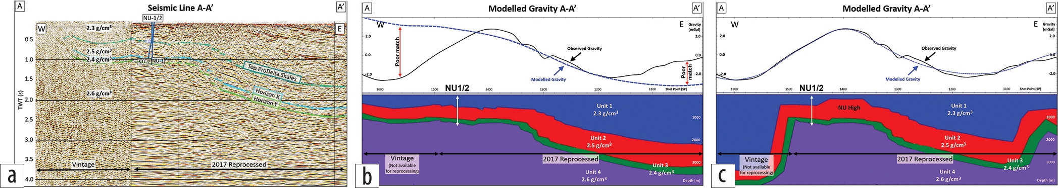
Balakrishnan Kunjan, Witan Ardjakusumah, Kevin McDonald, Hannah Booth, Seda Rouxel (Cue Energy), and Asbjorn Norlund Christensen (Nordic Geoscience) show you how in the article “Maintaining line of sight in oil and gas exploration: A case study from Mahakam Delta, Indonesia” in the August 2020 issue of The Leading Edge. The NU prospect, located in the Mahakam Hilir PSC on East Kalimantan, Borneo, is an example in which geologic chance of success (GCOS) predictions can change over time with increasing acquisition and availability of geophysical and geologic data and the studies done on them. After a series of four wells was […]
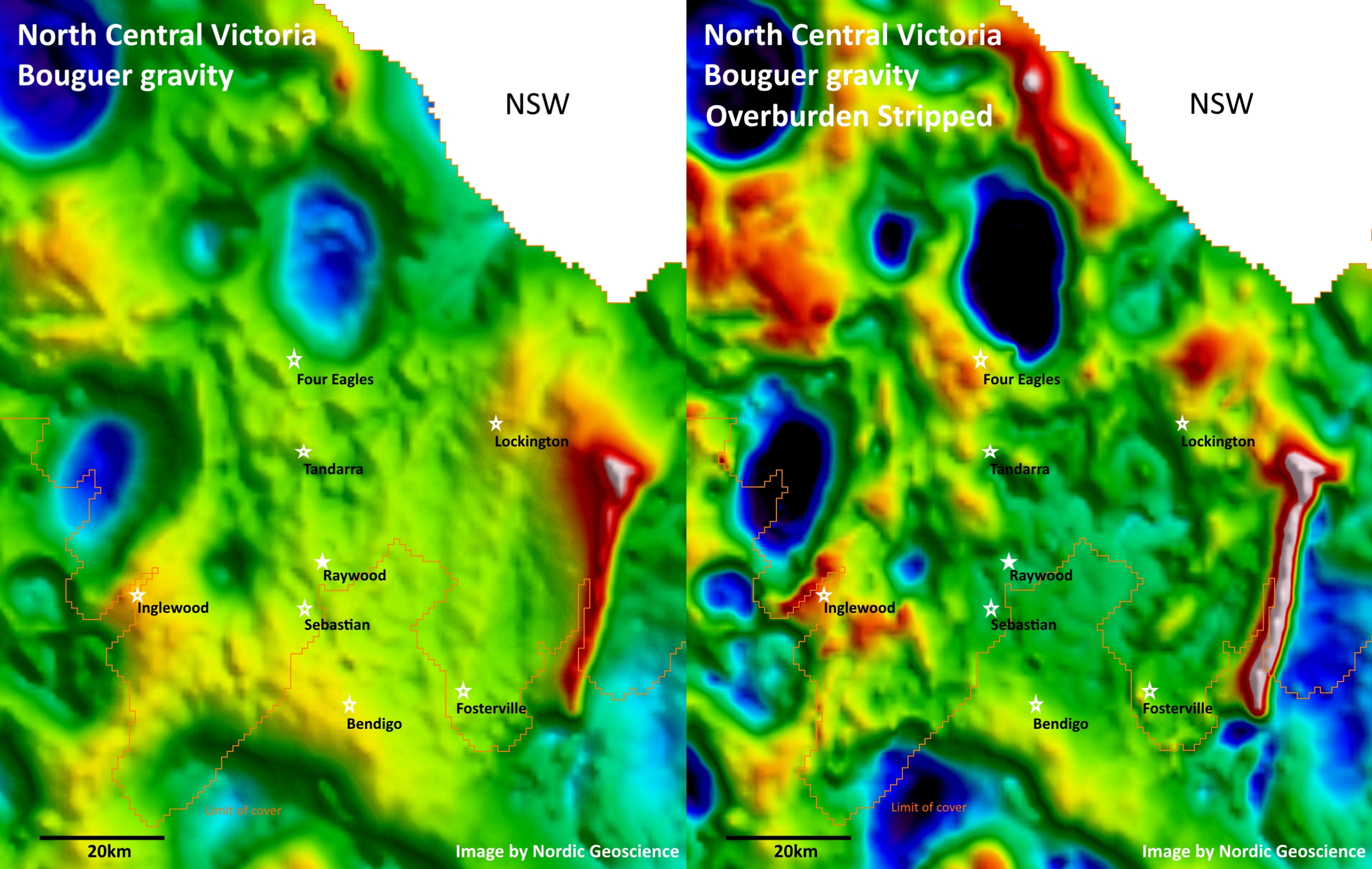
Gravity Stripping
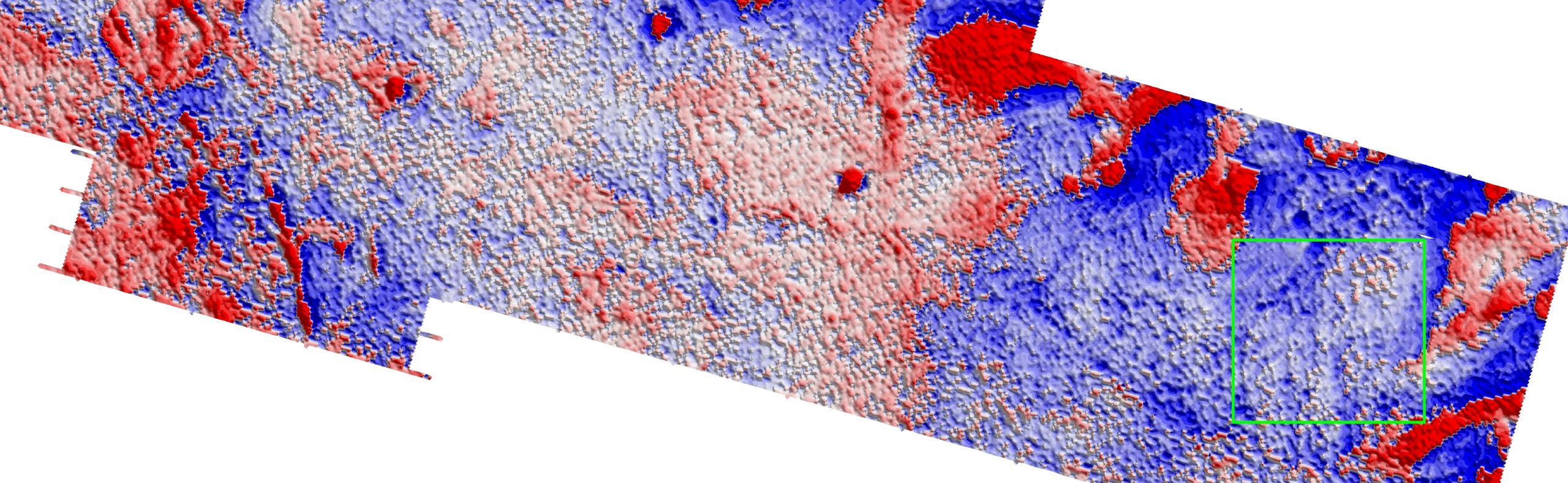
Your average gravity anomaly map contains contributions from both shallow and deep-seated geology. If you don’t have any additional constraints, then your interpretation will be ambiguous. However, if you have independent information about the near-surface cover sequence, then you can (1) model the gravity response of the overburden, (2) subtract the modelled response from the observed gravity data, and (3) thus lay bare the gravity responses from the underlying bed rock. This time-honoured technique is called “gravity-stripping”. Here is an example by Nordic Geoscience from North Central Victoria, showing both the public-domain Bouguer gravity data from Geoscience Australia, along with […]
Thomas Edison – Geophysicist and Prospector
In 1901 a 56-year old Thomas Edison arrived in the small Falconbridge township near Sudbury, Ontario, Canada, with his wife and brother-in-law. He had already invented the electric light bulb, the phonograph, and the motion picture camera, but those days were far behind him. He was there to prospect for nickel. But this story really began 45 years earlier… Magnetic Indications of Sudbury Deposits In 1856, a map surveyor, W.A. Salter, was running surveying lines near Sudbury when he “discovered considerable local [magnetic] attraction, the needle varying between from four to fourteen degrees westerly”. He later met another surveyor, Alexander […]
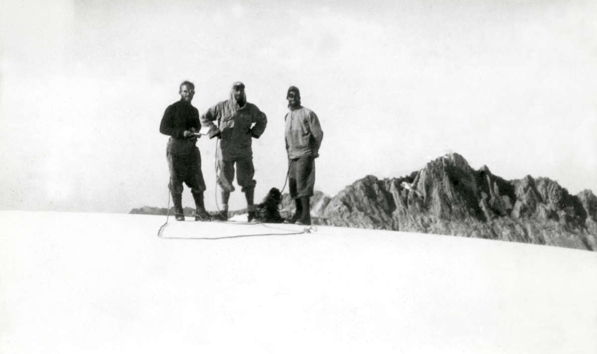
Three amateur montaineers stumble upon a mountain of gold.
The date is December 5th 1936, and the three friends on the picture have reasons to be happy: they have just successfully made the first ascent of what was then the highest mountain between the Himalayas and the Andes: the 4,900 m Ngga Pulu in Dutch New Guinea. Incidentally one of them has also just discovered what would become one of the largest gold and copper deposits in the world! Snow on the Equator On a rare clear day in February 1623 Dutch explorer Jan Carstenszoon had first sighted the glaciers on the peak of the mountain from his ship […]
Are there terrain effects lurking in your gravity data?
Have you used the right density in your gravity terrain correction? I once wasted two weeks doing field follow-up on a set of airborne gravity gradiometry targets. All turned out to be dusters. I later learned that a mistake had snuck into the initial processing of the airborne gravity gradient data. The gravity terrain correction had not been done as well as it possibly could have been. Needless to say, I have been slightly obsessive about gravity terrain corrections ever since. Gravity Terrain Corrections The gravity terrain correction attempts to remove the gravity effects of the surrounding hills and valleys […]
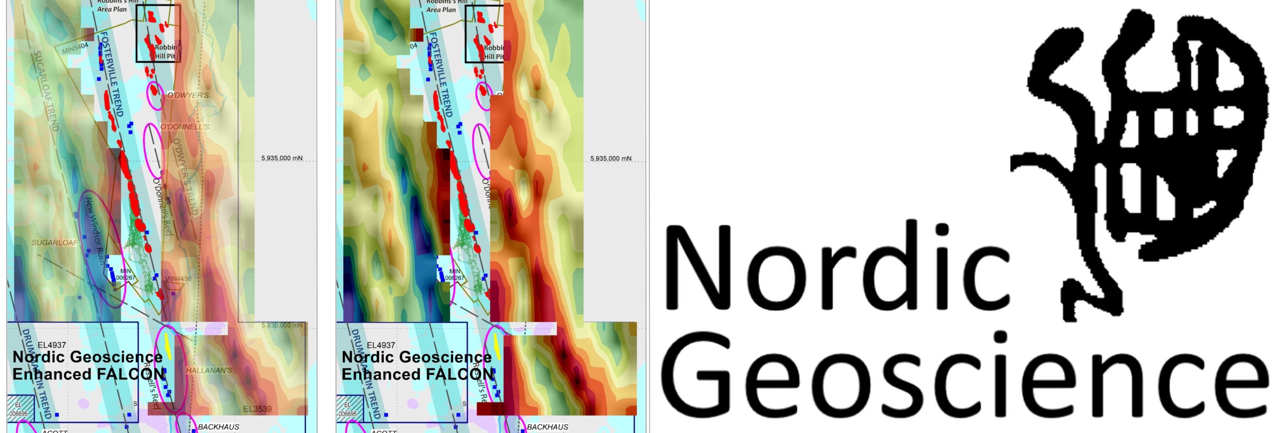
Airborne Gravity Gradiometry – A Game Changer in Victorian Gold Exploration under Cover?
Reprocessing of airborne gravity gradiometry data reveals prospective trends near Fosterville gold mine. The Fosterville gold mine in Central Victoria, Australia, is just a two-hour drive from Melbourne, where I am in COVID-19 lockdown for the third week running. The mine currently has reserves of 2.72 million oz. at 31 grams per tonne (g/t), and it is one of the world’s highest-grade, most profitable gold mines. Recent spectacular grade results at Fosterville has sparked a resurgence in gold exploration in Victoria, and airborne gravity gradiometry may well be the game changer as exploration moves further under cover north of Fosterville. […]